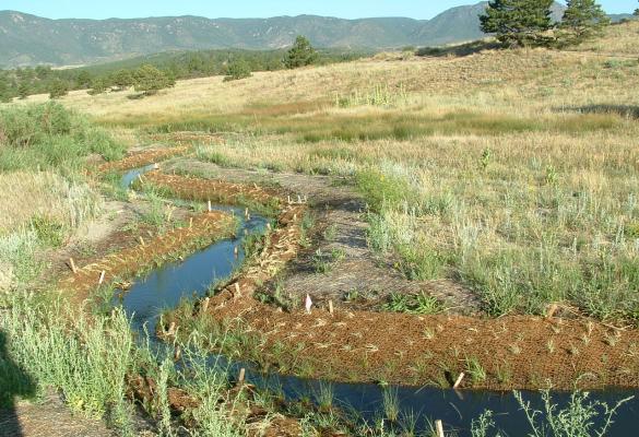
Floodplain Reconnection
A floodplain is a low-lying area directly adjacent to a waterbody and partially or fully flooded during high-water events (Demek 1988). Generally located on the floor of a river valley, floodplains provide a natural inundation area that aids with water retention during high flows. The ecology of a floodplain primarily consists of herbaceous vegetation, with peat bogs, streams, lakes and small stands of forest interspersed. All floodplain habitats are reliant on ample water for their ecological processes (Krizek 2006). Across the United States, development has resulted in disconnections between floodplains and their adjacent waterbodies (primarily rivers). Engineered river channels, levees, berms, channel straightening, dam construction, and high levels of water withdrawal are all drivers of floodplain disconnection (Loos and Shader 2016). Floodplain reconnection, also referred to as floodplain restoration, can take a variety of forms including dam removal, levee removal or setback, the aggradation of mainstem channels, restoration of floodplain habitat, and culvert replacement or removal (Pess et al. 2005).
Case Studies
Adaptive Management in Action: the Trinity River Restoration Program
Assessing Climate Risks in a National Estuary
Bird Track Springs Habitat Restoration on the Upper Grande Ronde River
Building Smart in the Floodplain
Ecological Response to Restored Flows in the Urban Santa Cruz River
Emiquon Wetland Restoration Project
Floodplain Restoration for Salmonid Habitat in the Yakima Basin
Habitat Restoration for Native Salmonid Conservation in the Lower American River of California
Increasing Water Availability for the Razorback Sucker on the Scott Matheson Wetland Preserve
Johnson Creek Restoration, Portland, Oregon
Kerry Island Esturary Restoration
Kissimmee River Restoration Project
Little Snake River Restoration on Three Forks Ranch
Lower Boulder Creek Ecosystem Restoration Project
Lower Red River Meadow Restoration Project
Otter Creek Floodplain, Middlebury, Vermont
Out of Harm's Way: Relocation Strategies to Reduce Flood Risk
Pecos National Historical Park Glorieta Creek Wetland-Riparian Restoration
Public-Private Partnerships for Rio Grande Silvery Minnow Habitat Restoration
Redman Point–Loosahatchie Bar Environmental Restoration
Steigerwald Reconnection Project
The Napa River Basin, California
The Nature Conservancy — Wetlands Restoration for Ecosystem and Community Resilience in He’eia O’ahu
Upgrading Water Infrastructure to Improve Fish Passage and Habitat in the Yolo Bypass
Using Woody Materials to Restore Crooked Creek
Water Transactions to Support Riparian Ecosystems in the Isleta Reach of the Rio Grande
Tools
Central Valley Flood Protection Plan
Floodplain Restoration Resources
Inter-Fluve Floodplain Reconnection Atlas
Mitigation Action Portfolio (MAP)
Mitigation Ideas: A Resource for Reducing Risk to Natural Hazards
Natural and Nature-Based Solutions Job Aid for Streambank Stabilization in Puerto Rico
Promoting Nature-Based Hazard Mitigation Through FEMA Mitigation Grants
Likely Benefits and Outcomes
This strategy is likely to achieve these project goals. Click to search for strategies with a similar benefit.
Related Green (natured-based) vs. Gray infrastructure
Explore opportunities to replace or supplement gray infrastructure with green infrastructure options.